Our Specialized Equipments:
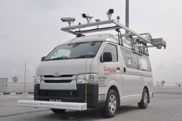
NETWORK SURVEY VEHICLE
The Network Survey Vehicle is a combination of many state-of-the-art technologies equipment designed for network and project level survey. It is a high-speed semi-automated vehicle equipped with digital laser profiling system, digital imaging system, road geometry and mapping system. These systems are designed to assess pavement surface conditions and generate GIS mapping for various road assets in the most efficient manner.
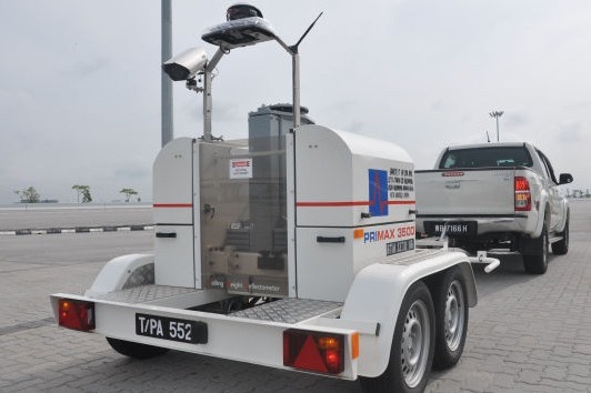
FALLING WEIGHT DEFLECTOMETER
The Falling Weight Deflectometer (FWD) performs non-destructive test to assess pavement strength adequacy. It imparts dynamic load to the pavement through a circular load plate to simulate moving wheel load. The vertical deformation of the pavement surface due to the load pulse is measured by geophones and can be used for pavement design and evaluation.
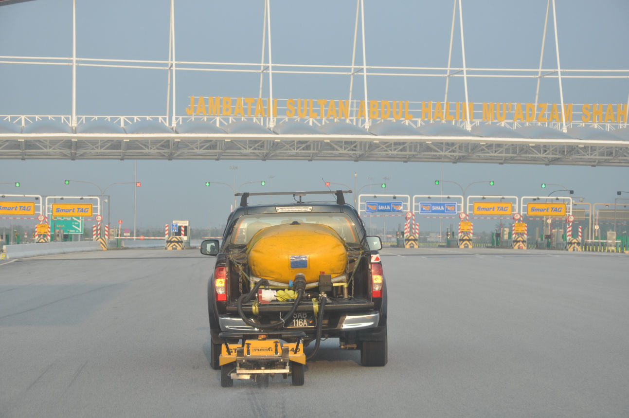
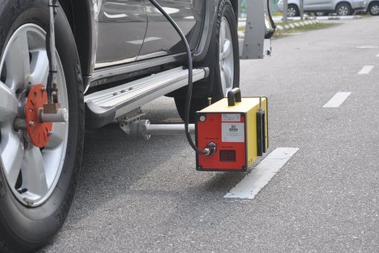
GRIP TESTER
The Grip Tester is a reliable, robust and easy to maintain
equipment for measuring pavement friction at high speed. It is
designed to collect longitudinal Friction Coefficient, defined
by ‘GRIPNUMBER’ Index, and has established correlation with
the Sideway-Force Coefficient Routine Investigation Machine
(SCRIM) value.
RETROREFLECTIVITY MEASUREMENT TOOLS
The LTL-M is a mobile retroreflectometer which measures
night-time visibility in full length of road markings
accurately at traffic speed. It can also measure daylight
contrast, width of markings, and record the presence of Raised
Road Pavement Markers (RRPM) such as road studs. The data
captured would provide thorough performance tracking of road
markings at network level.
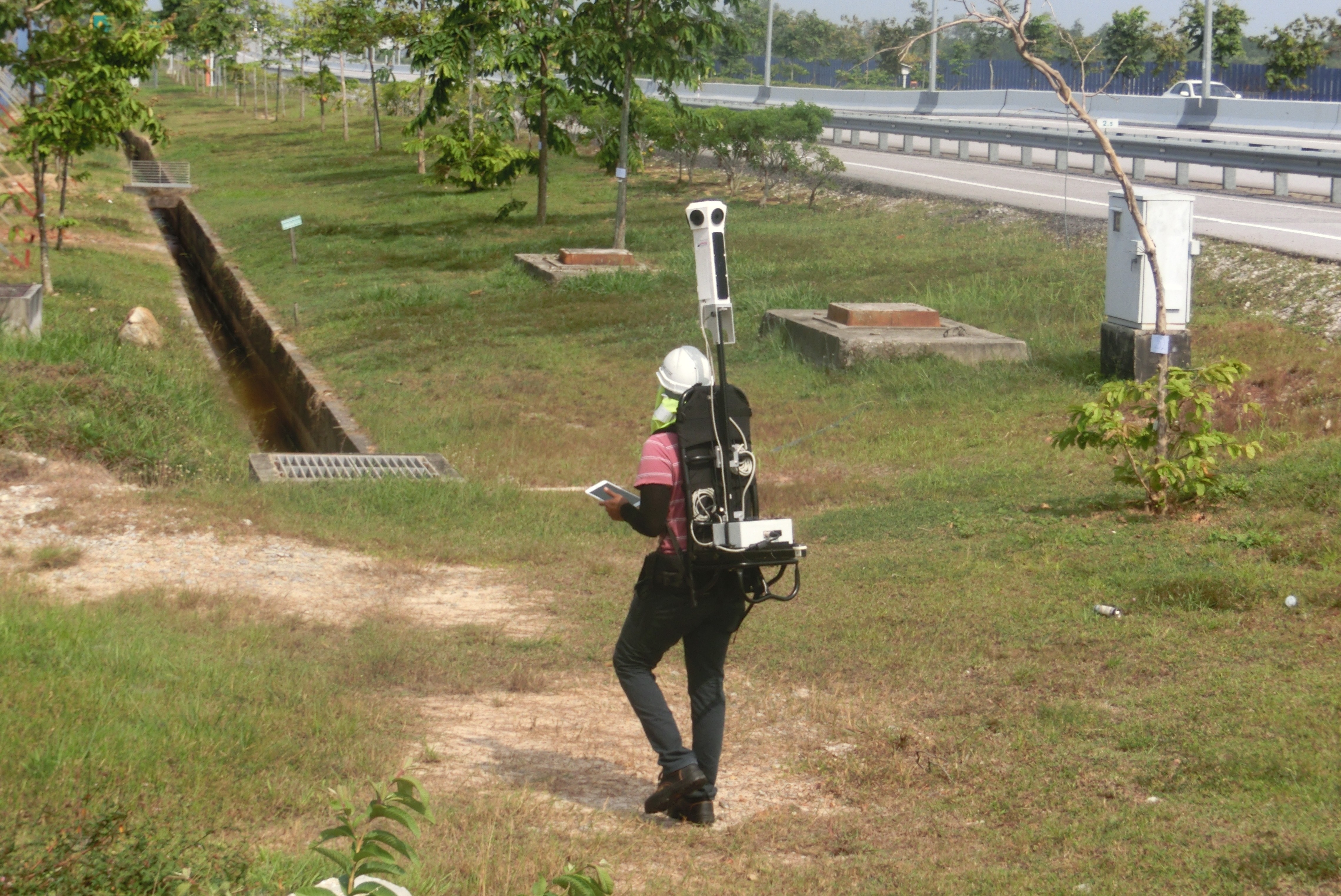
360° STREETVIEW CAM
Images captured with the 360 Streetview camera can be stitched
together to form a more comprehensive graphical representation
of the site.
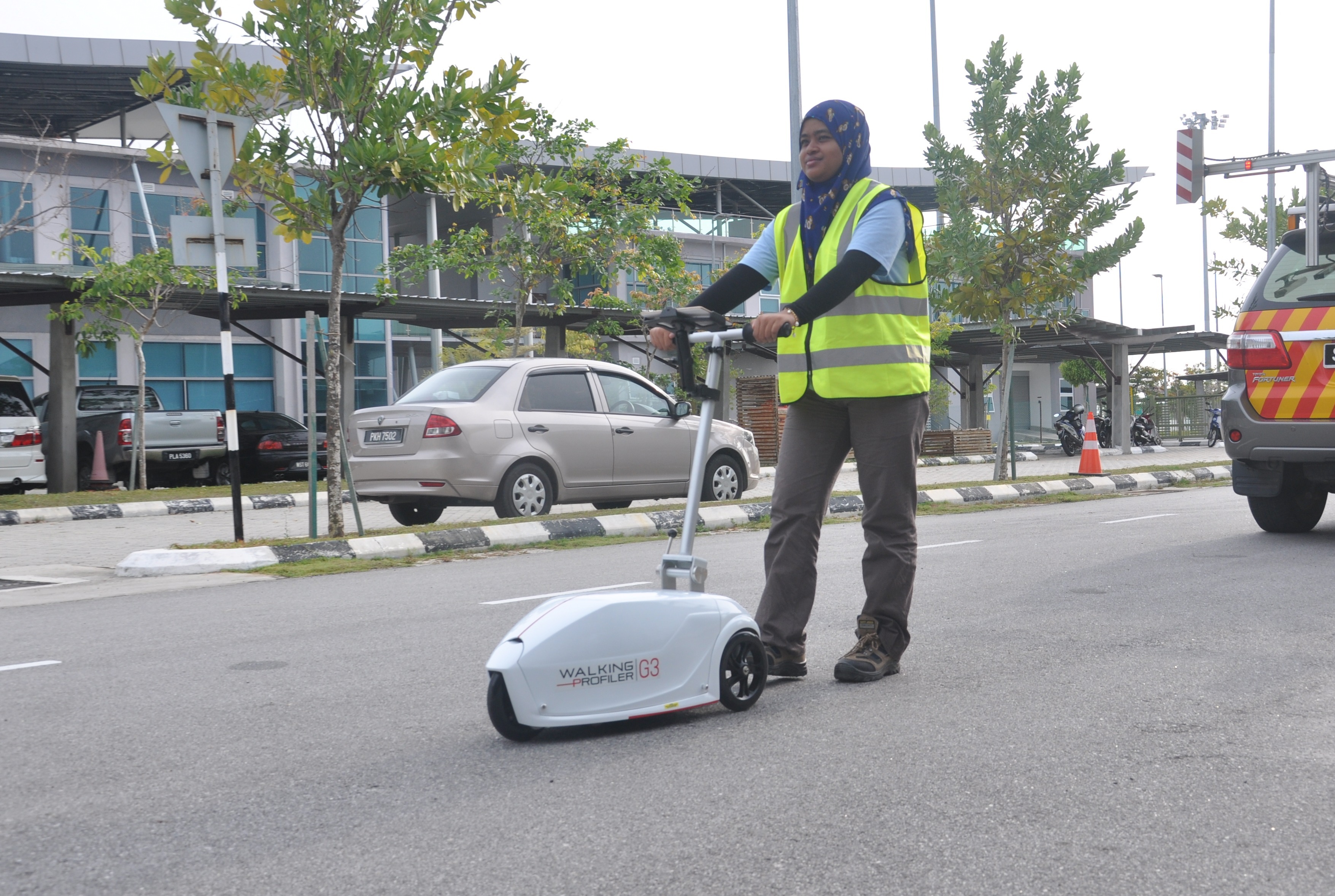
WALKING PROFILER
The walking profiler utilises a tri-axial accelerometer
mounted on a rolling platform to measure longitudinal profile
of the pavement. The International Roughness Index (IRI), MPD
texture (as an optional parameter) and distance can be
collected at variable speeds up to 5km/hr and controlled by an
android tablet. It is ideal for surfaces like paved roads,
footpaths, airfields, runaways, building slabs and bridges.
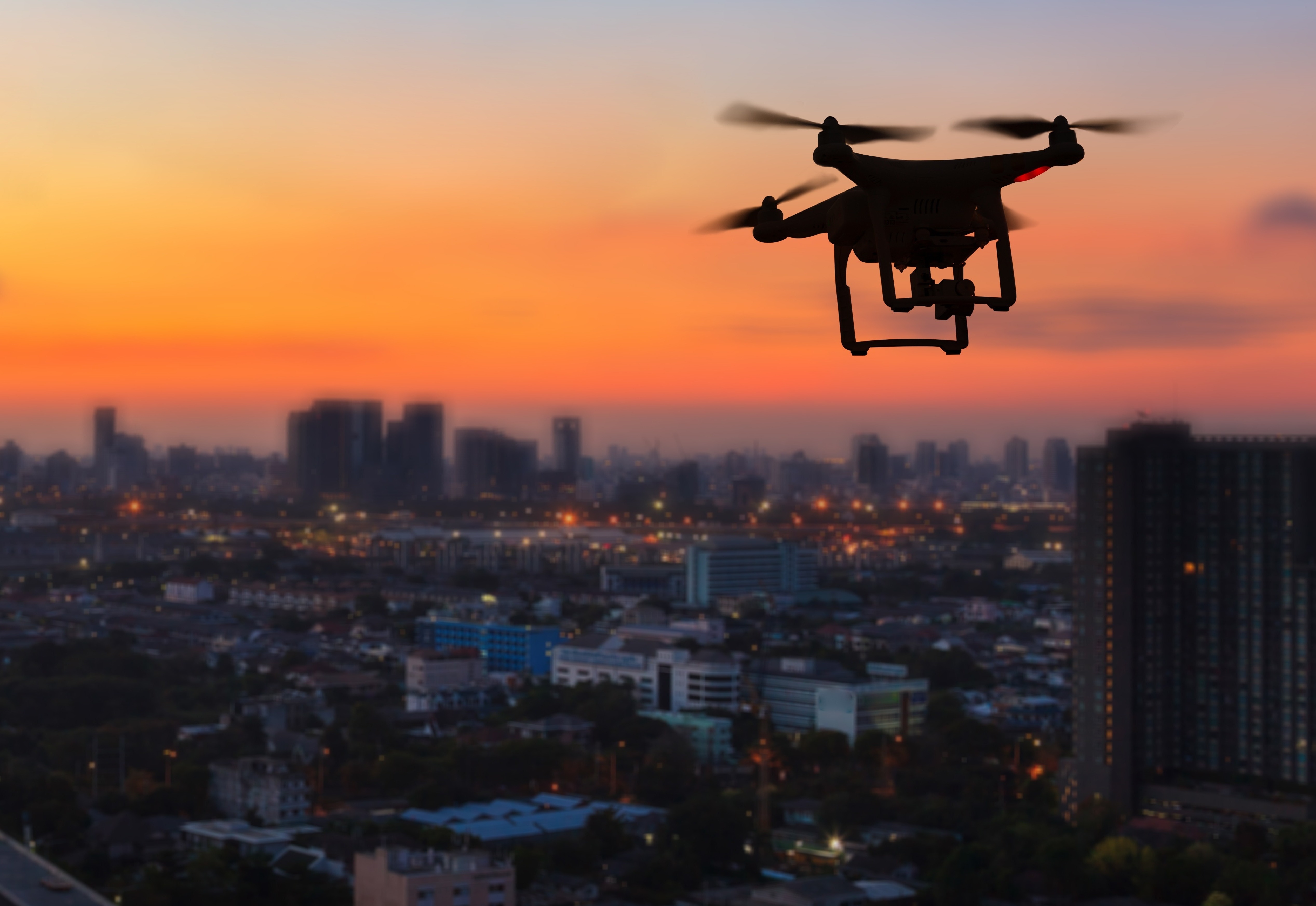
UNMANNED AERIAL VEHICLE (UAV)
An UAV is commonly known as a drone. It is an aircraft without
a human pilot, crew or passenger on board. Most commonly used
to perform a general visual inspection on structures such as
bridges, telco towers, solar energy and other hard to reach
installations. The equipment is able to capture image data
with a combination of Real time Kinematic and centimetre-level
accuracy. This captured image data able to generate an output
such as DEM, DSM, DTM and digitised map
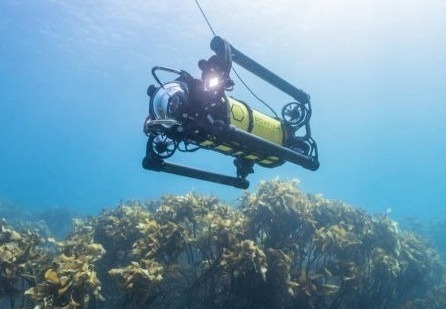
REMOTELY OPERATED VEHICLE (ROV)
The ROV is employed to perform general underwater visual
inspection on underwater structures such as bridge piles. It
is a compact and reliable machine suitable for underwater
inspection in steady or moving current whether it is inshore,
onshore or rivers. The real-time video capture enables
engineers to further study and analyze the condition of assets
on-site.